Share to: share facebook share twitter share wa share telegram print page


Saltoro Kangri

Saltoro Kangri
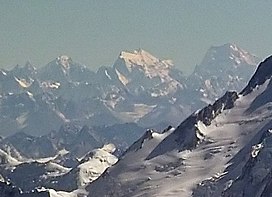
Saltoro Kangri, at right
Highest point
Elevation7,742 m (25,400 ft)Ranked 31st
Prominence2,160 m (7,090 ft)
ListingUltra
Coordinates35°23′57.6″N 76°50′55.2″E / 35.399333°N 76.848667°E / 35.399333; 76.848667
Dimensions
Length80 km (50 mi)
Geography
Saltoro Kangri is located in Karakoram
Saltoro Kangri
Saltoro Kangri
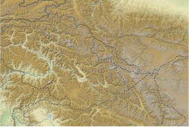
Saltoro Ridge, Siachen, Actual Ground Position Line, Saltoro Kangri on the border between Indian and Pakistani controlled territories
Saltoro Kangri is located in Gilgit Baltistan
Saltoro Kangri
Saltoro Kangri
Saltoro Kangri (Gilgit Baltistan)
Saltoro Kangri is located in Ladakh
Saltoro Kangri
Saltoro Kangri
Saltoro Kangri (Ladakh)
Map
About OpenStreetMaps
Maps: terms of use
45km
30miles
Pakistan
India
China
Gasherbrum V
48
Gasherbrum V
Rimo III
Rimo III
Apsarasas Kangri I
Apsarasas Kangri I
Diran
Diran
Muztagh Tower
Muztagh Tower
K6
K6
Yutmaru Sar
Yutmaru Sar
Baintha Brakk
Baintha Brakk
Crown Peak
Crown Peak
Baltoro Kangri
Baltoro Kangri
Yazghil Dome South
Yazghil Dome South
Sherpi Kangri
Sherpi Kangri
Rimo I, Rimo massif
Rimo I, Rimo massif
Ultar, Ultar Peak, Ultar Sar
Ghent Kangri
Ghent Kangri
Haramosh Peak
Haramosh Peak
Skil Brum
Skil Brum
Momhil Sar
Momhil Sar
Sia Kangri
Sia Kangri
K12
K12
Malubiting
Malubiting
Teram Kangri I
Teram Kangri I
Yukshin Gardan Sar
Yukshin Gardan Sar
Passu Sar
Passu Sar
Pumari Chhish
Pumari Chhish
Saser Kangri III
Saser Kangri III
Saser Kangri II
Saser Kangri II
Mamostong Kangri K35
Skyang Kangri
Skyang Kangri
Trivor Sar
Trivor Sar
Shispare or Shispare Sar
Chogolisa
Chogolisa
Saser Kangri I, K22
Saser Kangri I, K22
Batura III
Batura III
Saltoro Kangri, K10
Saltoro Kangri, K10
Kanjut Sar
Kanjut Sar
Batura II
Batura II
Rakaposhi
Rakaposhi
Batura Sar, Batura I
Masherbrum, K1
9
Masherbrum, K1
Kunyang Chhish (Kunyang Kish, Khunyang Chhish, Khinyang Chhish)
8
Kunyang Chhish (Kunyang Kish, Khunyang Chhish, Khinyang Chhish)
Distaghil Sar
7
Distaghil Sar
Gasherbrum IV, K3
6
Gasherbrum IV, K3
Gasherbrum III, K3a
5
Gasherbrum III, K3a
Gasherbrum II, K4
4
Gasherbrum II, K4
Broad Peak
3
Broad Peak
Gasherbrum I, K5
2
Gasherbrum I, K5
K2
1
K2
The major peaks in Karakoram are rank identified by height.

Legend:
1:K22:Gasherbrum I, K53:Broad Peak4:Gasherbrum II, K45:Gasherbrum III, K3a6:Gasherbrum IV, K37:Distaghil Sar8:Kunyang Chhish9:Masherbrum, K110:Batura Sar, Batura I11:Rakaposhi12:Batura II13:Kanjut Sar14:Saltoro Kangri, K1015:Batura III16: Saser Kangri I, K2217:Chogolisa18:Shispare19:Trivor Sar20:Skyang Kangri21:Mamostong Kangri, K3522:Saser Kangri II23:Saser Kangri III24:Pumari Chhish25:Passu Sar26:Yukshin Gardan Sar27:Teram Kangri I28:Malubiting29:K1230:Sia Kangri31:Momhil Sar32:Skil Brum33:Haramosh Peak34:Ghent Kangri35:Ultar Sar36:Rimo massif37:Sherpi Kangri38:Yazghil Dome South39:Baltoro Kangri40:Crown Peak41:Baintha Brakk42:Yutmaru Sar43:K644:Muztagh Tower45:Diran46:Apsarasas Kangri I47:Rimo III48:Gasherbrum V

 
Parent rangeSaltoro Mountains, Karakoram
Climbing
First ascent24 July 1962 by Y. Takamura, A. Saito, Capt. Bashir[1]
Easiest routerock/snow/ice climb
Saltoro Kangri
Traditional Chinese薩爾托洛崗日峰
Transcriptions

Saltoro Kangri, previously known as Peak 36, stands as the highest peak within the Saltoro Mountains subrange, which is part of the larger Karakoram range. This subrange is also referred to as the Saltoro Range and is situated within the Karakoram region. The term "Saltoro Kangri" typically encompasses both of its twin peaks, Saltoro Kangri I (located to the south) and Saltoro Kangri II, which are connected by a saddle. When comparing heights, the generic term "Saltoro Kangri" is used for the taller of the two peaks, Saltoro Kangri I. This peak ranks as the 31st highest mountain globally and is located in the remote reaches of the Karakoram. It lies on the Actual Ground Position Line, dividing Indian-controlled territory in the Siachen region from Pakistani-controlled territory to the west of the Saltoro Range.

Climbing history

The mountain underwent reconnaissance by Fanny Bullock Workman and her husband in the year 1911-12. The initial endeavor to conquer the peak, which was then denoted as "Peak 36," took place in 1935, led by a British expedition headed by James Waller and John Hunt.[2][3] Hunt's involvement in the expedition had been suggested by the Himalayan Club in Calcutta. Among the expedition's members were Rowland Brotherhood and Dr. Steward Carslaw, accompanied by two Sherpas named Palden and Dawa Thondup.[4] Their approach to the mountain commenced from the Likah Glacier, with the objective of ascending the South East ridge. They successfully established a final camp on June 19th, yet their altitude estimation proved to be inaccurate. An attempt to reach the summit the following day, amidst worsening weather conditions, was thwarted as they were required to ascend an additional 3500 feet. Hunt and Brotherhood managed to reach an elevation of 24,500 feet but were compelled to turn around.[5]

In 1957, under the leadership of Eric Shipton, a British university expedition approached the mountain via the Bilafond La route, entering from Pakistan and operating under a Pakistani climbing permit. However, they chose not to make a summit attempt. Unintentionally, this expedition marked the initial maneuver in the consequential oropolitics dispute over the Siachen conflict, ultimately culminating in the Siachen conflict of 1984.[6]

The first ascent of Saltoro Kangri was in July 1962, by a joint Japanese-Pakistani expedition led by T. Shidei. This piggyback expedition put A. Saito, Y. Takamura and Pakistani climber R.A. Bashir on the top on July 24, following the S.E. ridge route.[1][7] The peak was again climbed by an Indian Army expedition led by Colonel Narendra Kumar in 1981.[8] US maps of the area and many world atlases starting in the 1960s showed the Line of Control between Pakistani and Indian territory running from the last defined point in the 1949 Karachi Agreement, NJ9842, east-northeast to the Karakoram Pass, thus putting the whole of Saltoro Kangri and the entire Siachen Glacier in Pakistan. However, the Simla Agreement defined the Line of Control no further than point NJ9842 other than with the phrase "thence north to the glaciers." The Himalayan Index lists only one more ascent of the mountain, in 1981, and no other attempts.

References

  1. ^ a b Shidei, T. (1964). "The Ascent of Saltoro Kangri" (PDF). Alpine Journal. 69: 73–80. Retrieved 2020-01-15.
  2. ^ Hunt, John (1936). "Peak 36, Saltoro Karakoram, 1935". Himalayan Journal. 8. Retrieved 2020-01-15.
  3. ^ Hunt, John; Waller, James (1937). "Peak 36, Saltoro Karakoram A Mountaineering Analysis". Himalayan Journal. 9. Retrieved 2020-01-15.
  4. ^ Waller, James (1939). The Everlasting Hills. William Blackwood & Sons.
  5. ^ Hunt, John (1978). Life Is Meeting. London: Hodder and Stoughton. pp. 35–44. ISBN 0340229632.
  6. ^ Miller, K.J. (1958). "The Imperial College Karakoram Expedition, 1957". Himalayan Journal. 21. Retrieved 2020-01-15.
  7. ^ Shidei, T. (1964). "The Ascent of Saltoro Kangri". Himalayan Journal. 25. Retrieved 2020-01-15.
  8. ^ Kapadia, Harish (2005). Into the Untravelled Himalaya: Travels, Treks, and Climbs. Indus Publishing. p. 245. ISBN 9788173871818. Retrieved 2020-01-15.

Further reading

  • Jill Neate, High Asia: An Illustrated History of the 7000 Metre Peaks, ISBN 0-89886-238-8
Kembali kehalaman sebelumnya