Share to: share facebook share twitter share wa share telegram print page


Trout Lake, Washington

Trout Lake, Washington
Location of Trout Lake in Klickitat County, Washington
Coordinates: 45°59′44″N 121°31′14″W / 45.99556°N 121.52056°W / 45.99556; -121.52056
CountryUnited States
StateWashington
CountyKlickitat
Area
 • Total
6.98 sq mi (18.08 km2)
 • Land6.94 sq mi (17.97 km2)
 • Water0.04 sq mi (0.11 km2)
Elevation1,900 ft (600 m)
Population
 (2020)
 • Total
672
 • Density96/sq mi (37/km2)
Time zoneUTC-8 (Pacific (PST))
 • Summer (DST)UTC-7 (PDT)
ZIP code
98650
Area code509
FIPS code53-72450[2]
GNIS feature ID2409351[1]

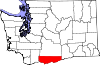
Trout Lake is an unincorporated community and census-designated place (CDP) in Klickitat County, Washington, United States. The population was 672 at the 2020 census. The town is notable for its organic dairy and herb farms, and as an access point to Mount Adams and the Gifford Pinchot National Forest.

Geography

Mount Adams from Trout Lake Highway

Trout Lake is in the northwest corner of Klickitat County, 14 miles (23 km) south of the 12,276-foot (3,742 m) summit of Mount Adams. State Route 141 passes through the community, traveling 22 miles (35 km) south to the town of White Salmon and 5 miles (8 km) west to its terminus at Gifford Pinchot National Forest.

According to the United States Census Bureau, the Trout Lake CDP has a total area of 7.0 square miles (18.1 km2), of which 0.04 square miles (0.1 km2), or 0.61%, are water.[3] The community sits in the Trout Lake Valley, drained to the southeast by Trout Lake Creek which flows to the White Salmon River, a south-flowing tributary of the Columbia River.

Climate

Climate data for Mount Adams Ranger Sation, Washington, 1991–2020 normals: 1950ft (594m)
Month Jan Feb Mar Apr May Jun Jul Aug Sep Oct Nov Dec Year
Mean daily maximum °F (°C) 38.6
(3.7)
43.2
(6.2)
49.3
(9.6)
58.0
(14.4)
67.6
(19.8)
73.9
(23.3)
83.9
(28.8)
83.7
(28.7)
75.2
(24.0)
59.8
(15.4)
45.2
(7.3)
36.8
(2.7)
59.6
(15.3)
Daily mean °F (°C) 32.2
(0.1)
34.8
(1.6)
39.3
(4.1)
45.6
(7.6)
53.7
(12.1)
59.4
(15.2)
66.9
(19.4)
66.4
(19.1)
58.8
(14.9)
47.5
(8.6)
37.5
(3.1)
31.1
(−0.5)
47.8
(8.8)
Mean daily minimum °F (°C) 25.8
(−3.4)
26.5
(−3.1)
29.3
(−1.5)
33.2
(0.7)
39.9
(4.4)
44.9
(7.2)
49.8
(9.9)
49.1
(9.5)
42.4
(5.8)
35.1
(1.7)
29.8
(−1.2)
25.3
(−3.7)
35.9
(2.2)
Average precipitation inches (mm) 8.16
(207)
5.13
(130)
4.71
(120)
2.35
(60)
1.55
(39)
1.03
(26)
0.34
(8.6)
0.67
(17)
1.38
(35)
3.52
(89)
7.04
(179)
7.82
(199)
43.71
(1,110)
Average snowfall inches (cm) 34.0
(86)
15.4
(39)
8.4
(21)
1.3
(3.3)
0
(0)
0
(0)
0
(0)
0
(0)
0
(0)
0.1
(0.25)
7.2
(18)
28.0
(71)
94.4
(240)
Source 1: NOAA[4]
Source 2: WRCC (precipitation & snowfall)[5]

Demographics

Historical population
CensusPop.Note
2010557
202067220.6%
US Decennial Census[6]
2020 Census[7]

As of the 2010 United States Census,[8] there were 557 people, 224 households, and 171 families residing in the CDP. The population density was 78.5 people per square mile. There were 290 housing units at an average density of 40.8/sq mi. The racial makeup of the CDP was 92.6% White, 0.2% Black, 0.9% Native American, 0.7% Asian, 2.5% from other races, and 3.1% from two or more races. Hispanic or Latino of any race were 5.2% of the population.

There were 224 households, out of which 28.1% included children under the age of 18, 64.7% included a married husband and wife, 4.0% included a male householder with no wife present, 7.6% had a female householder with no husband present, and 23.7% were non-families. The average household size was 2.46 and the average family size was 2.81.

The demographic spread included 130 (23.3%) under the age of 18, 329 (59.1%) aged 20 to 64, and 85 (15.3%) who were 65 years of age or older. By gender, the population was 51.7% (288) male and 48.3% (269) female. The median age was 44.8 years.

In 2011, the American Community Survey estimated a median income of $31,563 (adjusted for inflation, 2011 dollars) for an individual, and $56,250 for a household.[9]

References

  1. ^ a b U.S. Geological Survey Geographic Names Information System: Trout Lake, Washington
  2. ^ "U.S. Census website". United States Census Bureau. Retrieved January 31, 2008.
  3. ^ "Geographic Identifiers: 2010 Census Summary File 1 (G001), Trout Lake CDP, Washington". American FactFinder. U.S. Census Bureau. Archived from the original on February 13, 2020. Retrieved July 11, 2019.
  4. ^ "Mt Adams RS, Washington 1991-2020 Monthly Normals". Retrieved October 6, 2023.
  5. ^ "Mount Adams Ranger Stn, WA". Western Regional Climate Center. Retrieved February 18, 2016.
  6. ^ "US Gazetteer files: 2010, 2000, and 1990". United States Census Bureau. February 12, 2011. Retrieved April 23, 2011.
  7. ^ "Census Bureau profile: Trout Lake, Washington". United States Census Bureau. May 2023. Retrieved May 13, 2024.
  8. ^ "U.S. Census website". United States Census Bureau. Retrieved May 14, 2011.
  9. ^ "American Community Survey". US Census Bureau. Archived from the original on February 12, 2020.
Kembali kehalaman sebelumnya


Index: pl ar de en es fr it arz nl ja pt ceb sv uk vi war zh ru af ast az bg zh-min-nan bn be ca cs cy da et el eo eu fa gl ko hi hr id he ka la lv lt hu mk ms min no nn ce uz kk ro simple sk sl sr sh fi ta tt th tg azb tr ur zh-yue hy my ace als am an hyw ban bjn map-bms ba be-tarask bcl bpy bar bs br cv nv eml hif fo fy ga gd gu hak ha hsb io ig ilo ia ie os is jv kn ht ku ckb ky mrj lb lij li lmo mai mg ml zh-classical mr xmf mzn cdo mn nap new ne frr oc mhr or as pa pnb ps pms nds crh qu sa sah sco sq scn si sd szl su sw tl shn te bug vec vo wa wuu yi yo diq bat-smg zu lad kbd ang smn ab roa-rup frp arc gn av ay bh bi bo bxr cbk-zam co za dag ary se pdc dv dsb myv ext fur gv gag inh ki glk gan guw xal haw rw kbp pam csb kw km kv koi kg gom ks gcr lo lbe ltg lez nia ln jbo lg mt mi tw mwl mdf mnw nqo fj nah na nds-nl nrm nov om pi pag pap pfl pcd krc kaa ksh rm rue sm sat sc trv stq nso sn cu so srn kab roa-tara tet tpi to chr tum tk tyv udm ug vep fiu-vro vls wo xh zea ty ak bm ch ny ee ff got iu ik kl mad cr pih ami pwn pnt dz rmy rn sg st tn ss ti din chy ts kcg ve 
Prefix: a b c d e f g h i j k l m n o p q r s t u v w x y z 0 1 2 3 4 5 6 7 8 9