Share to: share facebook share twitter share wa share telegram print page


Soest, Netherlands

Soest
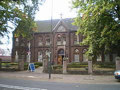
Church in Soest
Church in Soest
Flag of Soest
Coat of arms of Soest
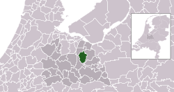
Highlighted position of Soest in a municipal map of Utrecht
Location in Utrecht
Coordinates: 52°11′N 5°18′E / 52.183°N 5.300°E / 52.183; 5.300
CountryNetherlands
ProvinceUtrecht
Government
 • BodyMunicipal council
 • MayorRob Metz (VVD)
Area
 • Total
46.43 km2 (17.93 sq mi)
 • Land46.24 km2 (17.85 sq mi)
 • Water0.19 km2 (0.07 sq mi)
Elevation13 m (43 ft)
Population
 (January 2021)[4]
 • Total
46,906
 • Density1,014/km2 (2,630/sq mi)
Demonym(s)Soestenaar, Soester
Time zoneUTC+1 (CET)
 • Summer (DST)UTC+2 (CEST)
Postcode
3760–3769
Area code035
Websitewww.soest.nl

Soest (Dutch pronunciation: [sust] ) is a municipality and town in the central Netherlands, in the province of Utrecht. It is about 6 km (4 mi) west of Amersfoort.

Population centres

The town of Soest

The oldest documents mentioning Soest (then written as Zoys) date from 1029. Its oldest church (the Oude Kerk, meaning Old Church), which is still in use today, dates from the fifteenth century. Traces of earlier habitation are found though. The area of "Hees", now at the outskirts of Soest may date in to the Early Middle Ages, and prehistoric burial mounds in the Soesterduinen point to early habitation in this area.

Topographic map of Soest

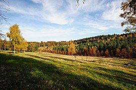
Agricultural activity is still visible as there is much farmland within Soest. The biggest area is in the center of the town, on a hill, and are called 'de Engh'. A small street is het Kerkpad (literally, the Church Path). The Soesterduinen (sand dunes), is a popular area for recreation.

Numerous churches depict the Calvinist/Catholic tradition of Soest and the region. Wilhelmina Kerk Soest, Gereformeerde Kerk Vrijgemaakt, Emmakerk and the Evangelie Gemeente Soest (meets in church building Julianakerk) are the main churches.

Soestduinen, meaning Soest Dunes, a small town between Soest and Soesterberg contains acres upon acres of sand dunes named the Lange Duinen (meaning the long dunes).

Currently some 50,000 inhabitants live in Soest, consisting mainly of commuters.

Transport

Soest has three railway stations:

The biggest of the three is Soest Zuid.

Soest can be reached by train from Utrecht (every half-hour, xx:06 and xx:36) and Baarn (xx:22 and xx:52); all trains stop at the three stations. The station of Soestduinen, situated between Utrecht Centraal and Amersfoort Centraal, was closed in 1998, after being in use for 135 years. It is now a restaurant.

The stations that can be reached directly from Soest are:

Soest has a number of bus stops and three bus lines, all of which leave from the bus station at Soest Zuid exactly at the half-hour. Line 70 however, travel both directions to Amersfoort and Hilversum. Line 74 travels within the town of Soest. And multiple others travel through Soest. (272 Bunschoten-Spakenburg to Uithof, Utrecht vv. More info found at 9292ov.nl for all the public transport connections

Notable people

Dirk Jan de Geer, 1930
Janine Jansen
  • Gerard Soest (c. 1600 – 1681) portrait painter who was active in England

Sport

Business

Sport

There are four football clubs in Soest: SEC, VV Hees, SO Soest and VVZ '49. Soesterberg has its own football club, VV 't Vliegdorp.

Twin towns – sister cities

Soest is twinned with:[7]

  • Germany Soest, Germany, since 2004

See also

References

  1. ^ "R.T. Metz" (in Dutch). Gemeente Soest. Archived from the original on 6 April 2013. Retrieved 9 April 2014.
  2. ^ "Kerncijfers wijken en buurten 2020" [Key figures for neighbourhoods 2020]. StatLine (in Dutch). CBS. 24 July 2020. Retrieved 19 September 2020.
  3. ^ "Postcodetool for 3762AV". Actueel Hoogtebestand Nederland (in Dutch). Het Waterschapshuis. Retrieved 9 April 2014.
  4. ^ "Bevolkingsontwikkeling; regio per maand" [Population growth; regions per month]. CBS Statline (in Dutch). CBS. 1 January 2021. Retrieved 2 January 2022.
  5. ^ IMDb Database retrieved 29 April 2019
  6. ^ IMDb Database retrieved 29 April 2019
  7. ^ "Stedenband Soest". Gemeente Soest. 6 June 2006. Archived from the original on 24 July 2011. Retrieved 28 April 2008.
Kembali kehalaman sebelumnya


Index: pl ar de en es fr it arz nl ja pt ceb sv uk vi war zh ru af ast az bg zh-min-nan bn be ca cs cy da et el eo eu fa gl ko hi hr id he ka la lv lt hu mk ms min no nn ce uz kk ro simple sk sl sr sh fi ta tt th tg azb tr ur zh-yue hy my ace als am an hyw ban bjn map-bms ba be-tarask bcl bpy bar bs br cv nv eml hif fo fy ga gd gu hak ha hsb io ig ilo ia ie os is jv kn ht ku ckb ky mrj lb lij li lmo mai mg ml zh-classical mr xmf mzn cdo mn nap new ne frr oc mhr or as pa pnb ps pms nds crh qu sa sah sco sq scn si sd szl su sw tl shn te bug vec vo wa wuu yi yo diq bat-smg zu lad kbd ang smn ab roa-rup frp arc gn av ay bh bi bo bxr cbk-zam co za dag ary se pdc dv dsb myv ext fur gv gag inh ki glk gan guw xal haw rw kbp pam csb kw km kv koi kg gom ks gcr lo lbe ltg lez nia ln jbo lg mt mi tw mwl mdf mnw nqo fj nah na nds-nl nrm nov om pi pag pap pfl pcd krc kaa ksh rm rue sm sat sc trv stq nso sn cu so srn kab roa-tara tet tpi to chr tum tk tyv udm ug vep fiu-vro vls wo xh zea ty ak bm ch ny ee ff got iu ik kl mad cr pih ami pwn pnt dz rmy rn sg st tn ss ti din chy ts kcg ve 
Prefix: a b c d e f g h i j k l m n o p q r s t u v w x y z 0 1 2 3 4 5 6 7 8 9