River in Central Java, Indonesia
Serayu RiverKali Serayu, Sungai Serayu, Ci Sarayu, Kali Seraju, Kali Serajoe, Chi Seraju, Serdju, Serajoe River
Serayu river at Kebasen, Banyumas
Location of river mouth
Show map of Java Serayu River (Indonesia)
Show map of Indonesia Country Central Java , Indonesia Source • location Mt. Prahu[ 1] Dieng Volcanic Complex ) • coordinates 7°18′41.9436″S 109°59′32.8056″E / 7.311651000°S 109.992446000°E / -7.311651000; 109.992446000 • elevation 2,565 m (8,415 ft)[ 1]
Mouth • location
Indian Ocean • coordinates
7°41′0.5604″S 109°6′24.9876″E / 7.683489000°S 109.106941000°E / -7.683489000; 109.106941000 • elevation
0 m (0 ft) Length 181 km (112 mi)[ 1] Basin size 3,738 km2 (1,443 sq mi)[ 2] 2 (1,689 sq mi)[ 1] Discharge • location Near mouth • average (Period: 2005–2014)441.19 m3 /s (15,580 cu ft/s)[ 2] 3 /s (14,700 cu ft/s) • minimum (Period: 2005–2014)131.4 m3 /s (4,640 cu ft/s)[ 2] • maximum (Period: 2005–2014)1,370.5 m3 /s (48,400 cu ft/s)[ 2]
Discharge • location Rawalo (Basin size: 2,631 km2 (1,016 sq mi)[ 1] • average (Period: 1971–1995)273.41 m3 /s (9,655 cu ft/s)[ 1] • minimum (Period: 1971–1995)58.8 m3 /s (2,080 cu ft/s)[ 1] • maximum (Period: 1971–1995)1,497 m3 /s (52,900 cu ft/s)[ 1]
Discharge • location Banjarnegara (Basin size: 704 km2 (272 sq mi)[ 1] • average (Period: 1978–1995)57.16 m3 /s (2,019 cu ft/s)[ 1] • minimum (Period: 1978–1995)17.3 m3 /s (610 cu ft/s)[ 1] • maximum (Period: 1978–1995)548 m3 /s (19,400 cu ft/s)[ 1]
River system Serayu River Tributaries • left Begaluh, Sapi • right Tulis, Merawu, Klawing, Tajum
The Serayu River is a river in Central Java , Indonesia , about 300 km southeast of the capital Jakarta .[ 3] [ 4]
Hydrology
The river spanned from northeast to southwest with a length of around 181 km , and crossing five kabupaten Wonosobo Regency , Banjarnegara Regency , Purbalingga Regency , Banyumas Regency , draining to Indian Ocean with estuarine located at Cilacap Regency .[ 5]
Geography
The river flows in the southern central area of Java with a predominantly tropical monsoon climate (designated as Am in the Köppen-Geiger climate classification).[ 6] [ 7] [ 8]
Uses
Mrica Dam is a hydroelectric power dam installed in the Serayu River.[ 9] [ 10]
Water rafting is one of the tourist attractions in the villages of Tunggara and Prigi, in Banjarnegara Regency .[ 11]
Gallery
Serayu river
Railroad construction by the Serayu near Kebasen, Banyumas
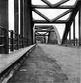
Railroad bridge across Serayu near Kebasen
Bridge at Rawalo, Banyumas
Bridge near Maos, Cilacap (before 1917)
Bridge built in 1890
Serayu river
See also
References
Sumatra Java Kalimantan Sulawesi Lesser Sunda Islands
Bali :Ayung , Sungi , Telaga Waja Lombok Babak , Dodokan , Jangkok Flores :Sissa , Wera Sumbawa :Brang Biji , Moyo Sumba :Kadassa , Kadumbul , Kambaniru , Melolo , Polapare West Timor :Benanain , Mina , Noel Besi , Pono Maluku Western Papua
7°41′17″S 109°06′02″E / 7.68806°S 109.10056°E / -7.68806; 109.10056


