Share to: share facebook share twitter share wa share telegram print page


Rafat, Jerusalem

Rafat
Arabic transcription(s)
 • Arabicرافات
Rafat
Rafat
Rafat is located in State of Palestine
Rafat
Rafat
Location of Rafat within Palestine
Coordinates: 31°52′14″N 35°11′32″E / 31.87056°N 35.19222°E / 31.87056; 35.19222
Palestine grid168/141
State State of Palestine
GovernorateJerusalem
Government
 • TypeVillage council
Area
 • Total
3,773 dunams (3.8 km2 or 1.5 sq mi)
Elevation
753 m (2,470 ft)
Highest elevation
800 m (2,600 ft)
Lowest elevation
753 m (2,470 ft)
Population
 (2017)
 • Total
2,941
 • Density770/km2 (2,000/sq mi)
Name meaningfrom personal name [1]

Rafat (Arabic: رافات) is a Palestinian town in the Jerusalem Governorate of the State of Palestine, located approximately 4 km (2.5 mi) southwest of the city of Ramallah in the central West Bank. According to the Palestinian Central Bureau of Statistics, it had a population of 2,941 in 2017.[2] Its total land area consists of 3,773 dunams.

Location

Rafat is located 10.9 km north-west of Jerusalem. It is bordered by Qalandiya to the east, Al Judeira to the north, Ramallah to the west, and Beituniya to the south.[3]

History

Ceramics from the Byzantine era have been found here.[4]

Ottoman era

Rafat, like the rest of Palestine, was incorporated into the Ottoman Empire in 1517, and in the census of 1596, the village was noted in the Nahiya of Quds of the Liwa of Quds. The population was 27 households, all Muslim. The villagers paid a fixed tax rate of 33.3% on various agricultural products, such as wheat, barley, summer crops, goats and/or beehives, in addition to "occasional revenues"; a total of 3,300 akçe.[5][6]

In 1838, it was noted as a Muslim village in the Jerusalem District.[7][8][9] During this time, residents from Rafat settled Danyal near al-Ramla, establishing it as a dependency – or satellite village – of their home village.[10]

In 1863 Victor Guérin found Rafat to have one hundred and twenty inhabitants, and was located on a mound. It had mosque is dedicated to Sheikh Ahmed. He further noted that in some houses several stones looked of an ancient appearance. In one house he found a fragment of a broken column.[11]

An Ottoman village list from about 1870 showed that rafat had 35 houses and a population of 100, though the population count included men, only.[12][13]

In 1883, the PEF's Survey of Western Palestine (SWP) described Rafat as: "a small hamlet on a ridge, with a spring to the west, and many rock cut tombs."[14]

In 1896 the population of Rafat was estimated to be about 195 persons.[15]

British Mandate era

The barrier in northern Jerusalem, which confines Rafat village (in the north) to an enclave under Israeli control.

In the 1922 census of Palestine conducted by the British Mandate authorities, Rafat had a population of 219 Muslims,[16] while according to the 1931 census Rafat had a population of 218 inhabitants, in 46 houses.[17]

In the 1945 statistics, Rafat had a population of 280 Muslims,[18] and a land area of 3,777 dunams.[19] Of this, 252 dunams were designated for plantations and irrigable land, 1,965 dunams were for cereals,[20] while 21 dunams were built-up.[21]

Jordanian era

In the wake of the 1948 Arab–Israeli War, and after the 1949 Armistice Agreements, Rafat came under Jordanian rule.

In 1961, the population of Rafat was 504.[22]

Post-1967

After the Six-Day War in 1967, Rafat has been under Israeli occupation. The population in the 1967 census conducted by the Israeli authorities was 499, 75% of whom originated from the Israeli territory.[23]

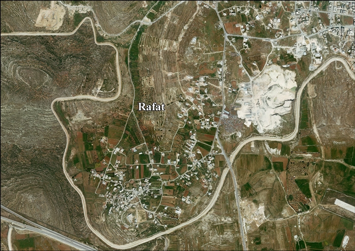
According to ARIJ Israel has confiscated 287 dunums of land (8.5% of the total area of the village) for the construction of Camp Ofer (later Ofer Prison). More lands have been confiscated from Rafat for the construction of the Israeli West Bank barrier. 637 dunums, which comprises 18.7% of the village’s total area, is isolated behind the wall, on the Israeli side.[24]

References

  1. ^ Palmer, 1881, p. 324
  2. ^ https://www.pcbs.gov.ps/Downloads/book2364-1.pdf .
  3. ^ Rafat Village Profile, ARIJ, 2012, p. 4
  4. ^ Dauphin, 1998, p. 843
  5. ^ Hütteroth and Abdulfattah, 1977, p. 118
  6. ^ Toledano, 1984, p. 298, gives the location as 31°52′20″N 35°11′20″E
  7. ^ Robinson and Smith, vol.3, Appendix 2, p. 122
  8. ^ Robinson and Smith, vol.2, p. 133
  9. ^ Robinson and Smith, vol.2, p. 135
  10. ^ Marom, Roy (2022). "Lydda Sub-District: Lydda and its countryside during the Ottoman period". Diospolis - City of God: Journal of the History, Archaeology and Heritage of Lod. 8: 124.
  11. ^ Guérin, 1868, pp. 392-393
  12. ^ Socin, 1879, p. 158
  13. ^ Hartmann, 1883, p. 127 noted 25 houses
  14. ^ Conder and Kitchener, 1883, SWP III, p. 13
  15. ^ Schick, 1896, p. 121
  16. ^ Barron, 1923, Table VII, Sub-district of Jerusalem, p. 14
  17. ^ Mills, 1932, p. 42
  18. ^ Government of Palestine, Department of Statistics, 1945, p. 25
  19. ^ Government of Palestine, Department of Statistics. Village Statistics, April, 1945. Quoted in Hadawi, 1970, p. 58
  20. ^ Government of Palestine, Department of Statistics. Village Statistics, April, 1945. Quoted in Hadawi, 1970, p. 104
  21. ^ Government of Palestine, Department of Statistics. Village Statistics, April, 1945. Quoted in Hadawi, 1970, p. 154
  22. ^ Government of Jordan, Department of Statistics, 1964, p. 23
  23. ^ Perlmann, Joel (November 2011 – February 2012). "The 1967 Census of the West Bank and Gaza Strip: A Digitized Version" (PDF). Levy Economics Institute. Retrieved 24 June 2016.
  24. ^ Rafat Village Profile, ARIJ, 2012, p. 16

Bibliography

Kembali kehalaman sebelumnya


Index: pl ar de en es fr it arz nl ja pt ceb sv uk vi war zh ru af ast az bg zh-min-nan bn be ca cs cy da et el eo eu fa gl ko hi hr id he ka la lv lt hu mk ms min no nn ce uz kk ro simple sk sl sr sh fi ta tt th tg azb tr ur zh-yue hy my ace als am an hyw ban bjn map-bms ba be-tarask bcl bpy bar bs br cv nv eml hif fo fy ga gd gu hak ha hsb io ig ilo ia ie os is jv kn ht ku ckb ky mrj lb lij li lmo mai mg ml zh-classical mr xmf mzn cdo mn nap new ne frr oc mhr or as pa pnb ps pms nds crh qu sa sah sco sq scn si sd szl su sw tl shn te bug vec vo wa wuu yi yo diq bat-smg zu lad kbd ang smn ab roa-rup frp arc gn av ay bh bi bo bxr cbk-zam co za dag ary se pdc dv dsb myv ext fur gv gag inh ki glk gan guw xal haw rw kbp pam csb kw km kv koi kg gom ks gcr lo lbe ltg lez nia ln jbo lg mt mi tw mwl mdf mnw nqo fj nah na nds-nl nrm nov om pi pag pap pfl pcd krc kaa ksh rm rue sm sat sc trv stq nso sn cu so srn kab roa-tara tet tpi to chr tum tk tyv udm ug vep fiu-vro vls wo xh zea ty ak bm ch ny ee ff got iu ik kl mad cr pih ami pwn pnt dz rmy rn sg st tn ss ti din chy ts kcg ve 
Prefix: a b c d e f g h i j k l m n o p q r s t u v w x y z 0 1 2 3 4 5 6 7 8 9