Share to: share facebook share twitter share wa share telegram print page


Boroughs of Amsterdam

Boroughs of Amsterdam
CategoryUrban district
LocationAmsterdam, Netherlands
Created
  • December 1981
Number7 (and 1 urban area) (as of 2022)
Populations86,862–157,964 (excluding Westpoort)[1]
Government
  • District committee (7)

The boroughs of Amsterdam (Dutch: stadsdelen; lit. "city parts") are the seven principal subdivisions of the municipality of Amsterdam, Netherlands.[2] Each borough is governed by a directly elected district committee (bestuurscommissie). The first Amsterdam boroughs were created in 1981, with other boroughs created in later years. The last area to be granted the status of borough was Amsterdam-Centrum (2002). The existing system of seven boroughs, covering most parts of Amsterdam, is the result of a major borough reform in 2010. The current boroughs have populations of around 80,000 to 150,000, which is the equivalent to an average-sized municipality in the Netherlands. Since 2022, there is also the urban area (Dutch: stadsgebied) Weesp.[2]

Borough government

Stadsdeelkantoor (district office) of the borough of Amsterdam-Zuidoost
Residual waste collection by the borough of Amsterdam-Centrum

Until 2014, the Amsterdam boroughs had the status of submunicipalities (deelgemeenten), a form of government which existed only in Amsterdam and Rotterdam. Westpoort, however, was governed by the central municipal authorities and therefore not a submunicipality. The submunicipalities were recognised under the Dutch Municipalities Act and enjoyed far-going autonomy, with the central municipal authorities abiding to the "submunicipalities decide, unless" principle.[3] The submunicipalities were governed by a directly elected district council (deelraad) as well as a separate district executive board, the members of which were appointed and controlled by the council. The central municipal authorities retained some power, especially in the areas of public order (police), budget, public transport and social security.

In 2013, the States General of the Netherlands adopted a revision of the Municipalities Act abolishing submunicipalities as a form of government.[4] Since the 2014 municipal elections, therefore, the Amsterdam district councils have ceased to exist. Under a municipal ordinance, however, they were replaced by smaller, but still directly elected district committees (bestuurscommissies).[5] All Dutch nationals, all EU nationals, as well as non-EU nationals who have lived in the Netherlands for at least three consecutive years, are eligible to vote for the district committee of the Amsterdam borough in which they live according to the city's civil register.[6] Each district committee elects three of its members to form an executive committee (dagelijks bestuur).

The district committees' jurisdiction is determined by the central municipal council. Responsibilities delegated to the 2018-2022 district committees include parks and recreation, streets and squares, refuse collection, permits and events, preparation of zoning plans, passports and drivers licenses, and welfare work.[7] As the new district committees depend on powers being delegated by the central municipal council, their position is far less autonomous than their predecessors. Instead, the district committees are considered to be the local 'eyes and ears' of the central municipal authorities, carrying out their delegated powers within the frameworks determined by the municipal council and the college van burgemeester en wethouders.[8]

List of boroughs

Since 2010, there are 7 boroughs (stadsdelen).[2][9] Westpoort (West Gateway) is not a borough, because it has a low population and it is directly governed by the municipality.

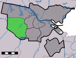
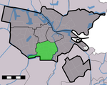
Borough Area Population Population density Location (in green) Neighbourhoods
Centrum
(Centre)
8.04 km2
86,422
13,748/km²
Binnenstad, Grachtengordel, Haarlemmerbuurt, Jodenbuurt, Jordaan, Kadijken, Lastage, Oosterdokseiland, Oostelijke Eilanden, Plantage, Rapenburg, Uilenburg, Westelijke Eilanden, Weteringschans
Nieuw-West
(New West)
32.38 km2
151,677
4,478/km²
Geuzenveld, Nieuw Sloten, Oostoever, Osdorp, Overtoomse Veld, Sloten, Slotermeer, Slotervaart
Noord
(North)
49.01 km2
94,766
2,269/km²
Banne Buiksloot, Buiksloot, Buikslotermeer, Floradorp, Kadoelen, Molenwijk, Nieuwendam, Nieuwendammerdijk en Buiksloterdijk, Oostzanerwerf, Overhoeks, Tuindorp Nieuwendam, Tuindorp Oostzaan
Oost
(East)
30.56 km2
135,767
7,635/km²
IJburg, Indische Buurt, Eastern Docklands, Oud-Oost, Watergraafsmeer
9.89 km2
143,842
15,252/km²
Frederik Hendrikbuurt, Houthaven, Spaarndammerbuurt, Staatsliedenbuurt, Zeeheldenbuurt, Westerpark, Kinkerbuurt, Overtoombuurt, De Baarsjes, Bos en Lommer, Kolenkitbuurt, Landlust, Sloterdijk
Zuid
(South)
17.41 km2
144,432
9,349/km²
Apollobuurt, Buitenveldert, Hoofddorppleinbuurt, Museumkwartier, De Pijp, Prinses Irenebuurt, Rivierenbuurt, Schinkelbuurt, Stadionbuurt, Vondelpark, Willemspark, Zuidas
Zuidoost
(Southeast)
22.08 km2
87,854
4,391/km²
Bijlmermeer, Venserpolder, Gaasperdam, Driemond, Weesp

Urban area

There is 1 urban area (stadsgebied) Weesp.[2] Weesp merged with Amsterdam in 2022.[10] It is located to the east of Zuidoost.

Urban area Area Population Population density Location (in green) Villages
24.16 km2
20,445
897/km²
Driemond

References

  1. ^ "Data en informatie".
  2. ^ a b c d "Stadsdelen". Gemeente Amsterdam. Archived from the original on 27 March 2023. Retrieved 20 July 2024.
  3. ^ "District Councils". Iamsterdam.com. Archived from the original on 2014-08-12. Retrieved 2014-08-10.
  4. ^ Vermeulen, Floris (2013-12-16). "Goodbye, city district councils. You will be missed for at least one unexpected reason". Retrieved 2014-08-10.
  5. ^ "Verordening op de bestuurscommissies 2013" (PDF). City of Amsterdam. Retrieved 2014-08-11.[permanent dead link]
  6. ^ "Amsterdam Local Elections". Iamsterdam.com. Archived from the original on 2014-08-09. Retrieved 2014-08-08.
  7. ^ "Bestuurlijk stelsel: stadsdelen en bestuurscommissies" (in Dutch). City of Amsterdam. Retrieved 2014-08-08.
  8. ^ "Bestuurlijk stelsel: Stadsdelen en Bestuurscommissies". City of Amsterdam. Retrieved 2014-08-10.
  9. ^ "1.2.1 Standgegevens, 1 januari 2017". Gemeente Amsterdam (in Dutch). Archived from the original on 2018-09-15. Retrieved 15 September 2018.
  10. ^ "Wet van 9 juni 2021 tot herindeling van de gemeenten Amsterdam en Weesp". www.officielebekendmakingen.nl/ (in Dutch). Archived from the original on 2021-10-16. Retrieved 2021-08-25.
Kembali kehalaman sebelumnya


Index: pl ar de en es fr it arz nl ja pt ceb sv uk vi war zh ru af ast az bg zh-min-nan bn be ca cs cy da et el eo eu fa gl ko hi hr id he ka la lv lt hu mk ms min no nn ce uz kk ro simple sk sl sr sh fi ta tt th tg azb tr ur zh-yue hy my ace als am an hyw ban bjn map-bms ba be-tarask bcl bpy bar bs br cv nv eml hif fo fy ga gd gu hak ha hsb io ig ilo ia ie os is jv kn ht ku ckb ky mrj lb lij li lmo mai mg ml zh-classical mr xmf mzn cdo mn nap new ne frr oc mhr or as pa pnb ps pms nds crh qu sa sah sco sq scn si sd szl su sw tl shn te bug vec vo wa wuu yi yo diq bat-smg zu lad kbd ang smn ab roa-rup frp arc gn av ay bh bi bo bxr cbk-zam co za dag ary se pdc dv dsb myv ext fur gv gag inh ki glk gan guw xal haw rw kbp pam csb kw km kv koi kg gom ks gcr lo lbe ltg lez nia ln jbo lg mt mi tw mwl mdf mnw nqo fj nah na nds-nl nrm nov om pi pag pap pfl pcd krc kaa ksh rm rue sm sat sc trv stq nso sn cu so srn kab roa-tara tet tpi to chr tum tk tyv udm ug vep fiu-vro vls wo xh zea ty ak bm ch ny ee ff got iu ik kl mad cr pih ami pwn pnt dz rmy rn sg st tn ss ti din chy ts kcg ve 
Prefix: a b c d e f g h i j k l m n o p q r s t u v w x y z 0 1 2 3 4 5 6 7 8 9