This page is subject to the extended confirmed restriction related to the Arab-Israeli conflict.
Municipality type C in Nablus, State of Palestine
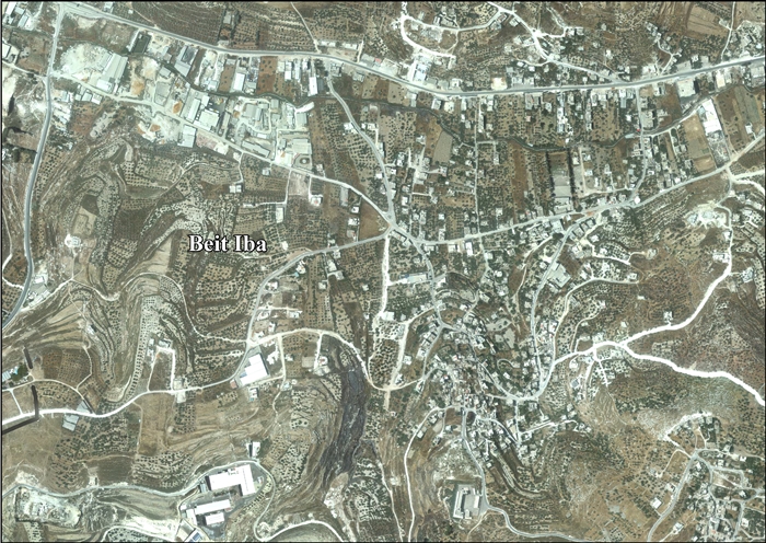
Beit Iba (Arabic : بيت إيبا ) is a Palestinian village in the Nablus Governorate in the North central West Bank , located 7 kilometers northwest of Nablus . According to the Palestinian Central Bureau of Statistics (PCBS), the village had a population of 4,079 inhabitants in 2017.[ 1]
Location
Beit Iba is located 5.13 kilometers (3.19 mi) west of Nablus . It is bordered by Nablus and Beit Wazan to the east, An-Naqura and Zawata to the north, Deir Sharaf and Qusin to the west, and Sarra and Beit Wazan to the south.[ 3]
History
Ceramics from the Byzantine era have been found here.[ 4]
Ottoman era
In 1517, the village was incorporated into the Ottoman Empire with the rest of Palestine , and in 1596, Beit Iba appeared in Ottoman tax registers as being in nahiya liwa' Nablus . It had a population of 20 households, all Muslims . They paid a fixed tax rate of 33,3% on wheat , barley , summer crops, olive trees, goats and/or beehives, in addition to occasional revenues and a tax on people in the Nablus district; a total of 9,000 akçe . Half to the revenue went to a Waqf .[ 5]
In 1838, in the Biblical Researches in Palestine , Beit Iba was located in the District of Jurat 'Amra , south of Nablus.[ 6] [ 7]
In 1870/1871 (1288 AH ), an Ottoman census listed the village with a population of 64 households in the nahiya [ 8]
In 1882, the PEF 's Survey of Western Palestine mud and stone, with a good spring ('Aines Subian); to the north. The olive groves in the valley are very fine and ancient; here and there is a small mill, and in spring a stream of water.[ 9]
British Mandate era
In the 1922 census of Palestine conducted by the British Mandate authorities , Beit Iba had a population of 456; all Muslims,[ 10] 1931 census to 470 Muslims, in a total of 121 houses.[ 11]
In the 1945 statistics , the population was 630, all Muslims,[ 12] dunams of land, according to an official land and population survey.[ 13] [ 14] [ 15]
Jordanian era
In the wake of the 1948 Arab–Israeli War Beit Iba came under Jordanian rule .
The Jordanian census of 1961 found 1,069 inhabitants in Beit Iba.[ 16]
1967 and aftermath
Since the Six-Day War in 1967, Beit Iba has been under Israeli occupation .
After the 1995 accords , 45% of the village land is defined as being in Area A , 34% is Area B , while the remaining 21% Area C .[ 17]
References
^ a b Preliminary Results of the Population, Housing and Establishments Census, 2017 (PDF) . Palestinian Central Bureau of Statistics (PCBS) (Report). State of Palestine . February 2018. pp. 64– 82. Retrieved 2023-10-24 .^ Palmer, 1881, p. 180
^ Beit Iba Village Profile , ARIJ, p. 4^ Dauphin, 1998, p. 771
^ Hütteroth and Abdulfattah, 1977, p. 132
^ Robinson and Smith, 1841, vol 3, Appendix 2, p. 127
^ Robinson and Smith, 1841, vol 3, p. 137
^ Grossman, David (2004). Arab Demography and Early Jewish Settlement in Palestine . Jerusalem: Magnes Press. p. 251. ^ Conder and Kitchener, 1882, SWP II, p. 162
^ Barron, 1923, Table IX, Sub-district of Nablus, p. 24
^ Mills, 1923, p. 60 .
^ Government of Palestine, Department of Statistics, 1945, p. 18 .
^ Government of Palestine, Department of Statistics. Village Statistics, April, 1945. Quoted in Hadawi, 1970, p. 59 .
^ Government of Palestine, Department of Statistics. Village Statistics, April, 1945. Quoted in Hadawi, 1970, p. 105 .
^ Government of Palestine, Department of Statistics. Village Statistics, April, 1945. Quoted in Hadawi, 1970, p. 155 .
^ Government of Jordan, Department of Statistics, 1964, p. 25
^ Beit Iba Village Profile , ARIJ, p. 15
Bibliography
Barron, J.B., ed. (1923). Palestine: Report and General Abstracts of the Census of 1922 Conder, C.R. ; Kitchener, H.H. (1882). The Survey of Western Palestine: Memoirs of the Topography, Orography, Hydrography, and Archaeology Committee of the Palestine Exploration Fund .Dauphin, C. (1998). La Palestine byzantine, Peuplement et Populations ISBN 0-860549-05-4 Government of Jordan, Department of Statistics (1964). First Census of Population and Housing. Volume I: Final Tables; General Characteristics of the Population (PDF) . Government of Palestine, Department of Statistics (1945). Village Statistics, April, 1945 Hadawi, S. (1970). Village Statistics of 1945: A Classification of Land and Area ownership in Palestine Hütteroth, W.-D. ; Abdulfattah, K. (1977). Historical Geography of Palestine, Transjordan and Southern Syria in the Late 16th Century ISBN 3-920405-41-2 Mills, E., ed. (1932). Census of Palestine 1931. Population of Villages, Towns and Administrative Areas Palmer, E.H. (1881). The Survey of Western Palestine: Arabic and English Name Lists Collected During the Survey by Lieutenants Conder and Kitchener, R. E. Transliterated and Explained by E.H. Palmer Committee of the Palestine Exploration Fund .Robinson, E. ; Smith, E. (1841). Biblical Researches in Palestine, Mount Sinai and Arabia Petraea: A Journal of Travels in the year 1838 Crocker & Brewster .
External links


