Talbot-Inseln
| Talbot-Inseln | ||
|---|---|---|
.png) | ||
| Gewässer | Pazifischer Ozean | |
| Archipel | Torres-Strait-Inseln | |
| Geographische Lage | 9° 15′ S, 142° 13′ O | |
| ||
| Anzahl der Inseln | 11 (3 Hauptinseln) | |
| Hauptinsel | Boigu | |
| Gesamte Landfläche | 107,26 km² | |
| Einwohner | 283 | |
 | ||


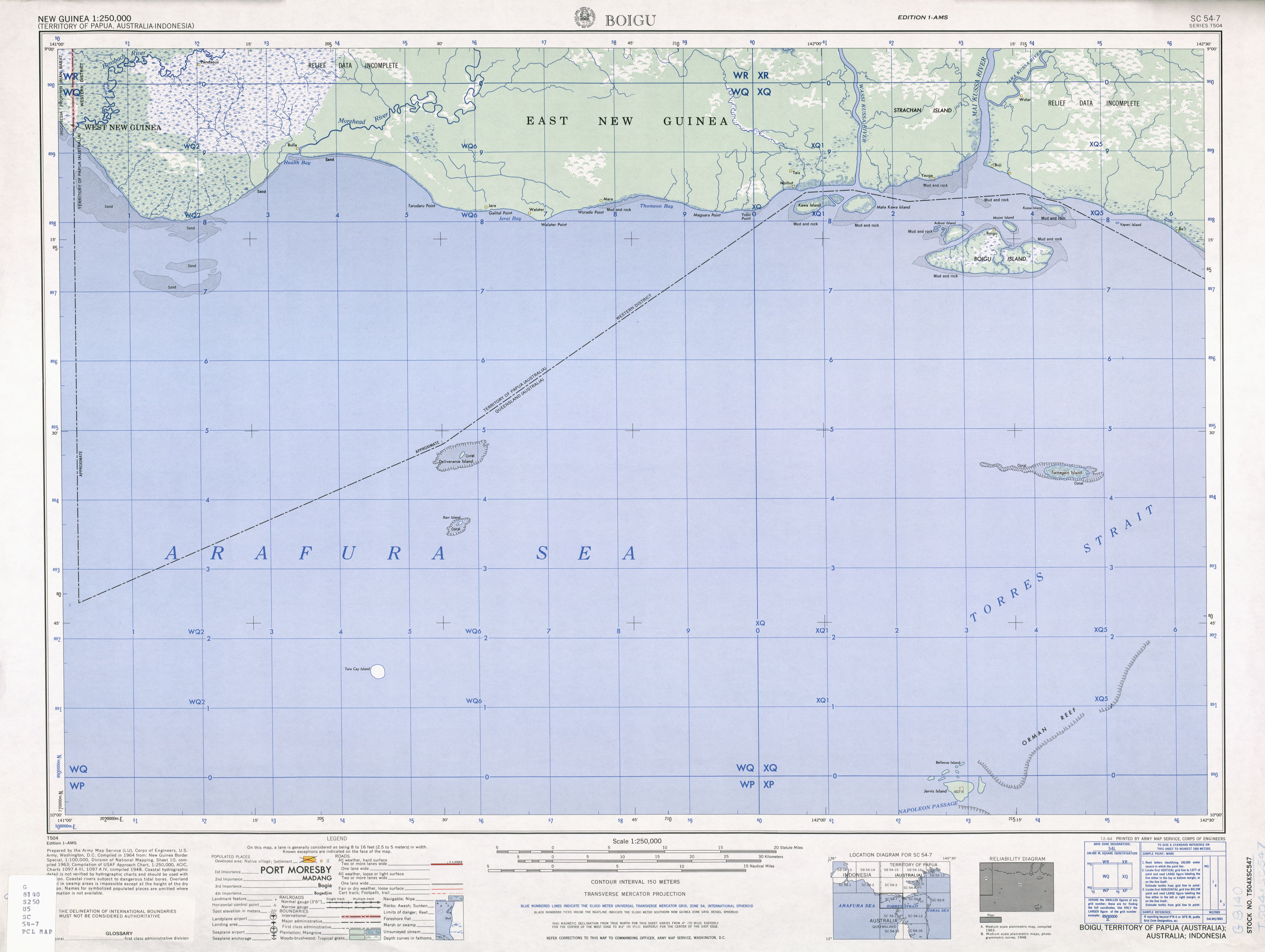
Die Talbot-Inseln sind eine Inselgruppe im Archipel der Torres-Strait-Inseln. Sie liegen wenige Kilometer vor der Südküste von Papua-Neuguinea in Höhe der Mündung des Mai Kussa River. Bis auf die ganz in Küstennähe gelegenen Inseln gehören sie zum australischen Bundesstaat Queensland.
Die Hauptinsel Boigu hatte 2006 271 Einwohner[1]; alle anderen Inseln der Gruppe sind unbewohnt.
Tabelle der Inseln

Zu den Talbot-Inseln gehören vor allem folgende Inseln:
| Inselname | Provinz (Staat) | Einwohner | Fläche km² |
Geokoordinaten |
|---|---|---|---|---|
| (Athian Maza) | Westprovinz (PNG) | unbewohnt | - | 09° 13′ S, 142° 17′ O |
| Aubusi | Queensland (AUS) | unbewohnt | 5,80 | 09° 14′ S, 142° 10′ O |
| Aymermud | Queensland (AUS) | unbewohnt | 0,70 | 09° 14′ S, 142° 09′ O |
| Boigu | Queensland (AUS) | 271 | 72,32 | 09° 16′ S, 142° 13′ O |
| Kawai-Inseln | Westprovinz (PNG) | unbewohnt | 20,66 | 09° 11′ S, 142° 00′ O |
| Kussa | Westprovinz (PNG) | unbewohnt | 4,90 | 09° 12′ S, 142° 18′ O |
| Moegina Kawa | Queensland (AUS) | unbewohnt | 0,38 | 09° 14′ S, 142° 09′ O |
| Moimi | Queensland (AUS) | unbewohnt | 2,06 | 09° 14′ S, 142° 14′ O |
| Yaperi | Westprovinz (PNG) | unbewohnt | 0,10 | 09° 13′ S, 142° 22′ O |
Anmerkung: In der Tabelle sind die unbenannten Inseln westlich von Aubusi Island (auf 9° 13′ 50″ S, 142° 9′ 4″ O) und Aymermud (auf 9° 13′ 50″ S, 142° 9′ 4″ O) mit einer Fläche von zusammen etwa 27 ha nicht enthalten.
Politik
Verwaltungsmäßig zählen die australischen Inseln zu den Top Western Islands, einer Inselregion im Verwaltungsbezirk Torres Shire von Queensland. Die restlichen Inseln gehören zur Westprovinz von Papua-Neuguinea.
Geschichte
Die Kawai-Inseln, rund 10 km nordwestlich von Boigu und wenige hundert Meter von der Küste Neuguineas, gehören noch zu den Talbot-Inseln.[2] Diese Inseln, sowie Kussa Island nordöstlich der Gruppe, wurden im Torres Strait Treaty von 1978 an Papua-Neuguinea übergeben.[3] Bis dahin erschienen sie auf Karten als zu Australien gehörig.[4]
Siehe auch
Einzelnachweise
- ↑ Census QuickStats: Boigu Island. Australian Bureau of Statistics, 2016, abgerufen am 1. März 2022 (australisches Englisch).
- ↑ Sailing Directions (enroute) Pub. 164 (PDF; 4,1 MB): The Kawaii Islands, constituting the rest of the group, are close off to the entrance to the Wassi Kussa River
- ↑ http://www.austlii.edu.au/au/other/dfat/treaties/1985/4.html
- ↑ http://www.lib.utexas.edu/maps/ams/new_guinea/txu-oclc-6552576-sc54-7.jpg
Weblinks
Content Disclaimer
Informasi ini disarikan dari Wikipedia dan disajikan kembali untuk tujuan edukasi. Konten tersedia di bawah lisensi CC BY-SA 3.0. Kami tidak bertanggung jawab atas ketidakakuratan data yang bersumber dari kontribusi publik tersebut.
- The information displayed on this website is sourced in part or in whole from Wikipedia and has been adapted for the purpose of restating it. We strive to provide accurate and relevant information, however:
- There is no guarantee of absolute accuracy. Wikipedia is an open, collaborative project that can be edited by anyone, so information is subject to change.
- It is not intended to constitute professional advice. The content displayed is for informational and educational purposes only. For important decisions (e.g., medical, legal, or financial), please consult a professional.
- Content copyright. Wikipedia is licensed under the Creative Commons Attribution-ShareAlike License (CC BY-SA). This means that content may be reused with appropriate attribution and shared under a similar license.
- Responsible use. Any risk arising from the use of information from this website is entirely the responsibility of the user.