Monida Pass
| Monida Pass | |
|---|---|
 Beaver Canyon | |
| Elevation | 6,870 ft (2,094 m) |
| Traversed by | |
| Location | Beaverhead County, Montana / Clark County, Idaho, U.S. |
| Range | Bitterroot Range, Rocky Mountains |
| Coordinates | 44°33′31″N 112°18′20″W / 44.55861°N 112.30556°W |
 Monida Pass Location in the United States | |

Monida Pass is a high mountain pass in the northern Rocky Mountains of the western United States, at an elevation of 6,870 feet (2,094 m) above sea level on Interstate 15, and 6,820 feet (2,079 m) on the Union Pacific Railroad.[citation needed]
On the Continental Divide in the Bitterroot Range, it marks the transition between the Beaverhead Mountains and the Centennial Mountains. Its name is derived from the states that it separates, "Mon" from Montana and "-ida" from Idaho.[1]
The pass forms part of the border between eastern Idaho and southwestern Montana, and is between the towns of Spencer in Clark County and Lima in Beaverhead County. On the Idaho side is Beaver Creek running through Beaver Canyon, which was the route of the Utah and Northern Railway in 1880 and is still used by Union Pacific.[2]

on Monida Pass


Union Pacific once had an icemaking plant at Humphrey, Idaho, which is now a ghost town; Monida, Montana, which is near the top of the pass, is also almost a ghost town, as only seven people now live there at 6,780 feet (2,067 m), ninety feet (27 m) below the pass on I-15.

In the late 19th century, stagecoaches ferried tourists from the railroad at Monida Pass to Yellowstone National Park, until UP built a branch line to the park over Reas Pass. Interstate 15, the "Veterans Memorial Highway," runs through the pass and north to the international boundary with Canada at Sweetgrass.[3]
See also
References
- ^ UltimateMontana.com Archived 2008-05-16 at the Wayback Machine. retrieved 2008-04-24.
- ^ Idaho Museum of Natural History - Digital Atlas of Idaho - Rocks, Rails & Trails - Part 3, History of Eastern Idaho - "The Gold Road & the Coming of the Railroads," Page 54. Retrieved 4 March 2007.
- ^ Montana Code Annotated 2005 Archived 2007-02-16 at the Wayback Machine - 60 Archived 2007-04-09 at the Wayback Machine-1 Archived 2007-04-10 at the Wayback Machine-203. Veterans memorial highway Archived 2007-11-09 at the Wayback Machine. Retrieved 4 March 2007.
- Ferrel, Hauck, Myers (1981). Colorado Rail Annual No. 15. the Colorado Railroad Museum. US 0-918654-15-7.
{{cite book}}: CS1 maint: multiple names: authors list (link) - Idaho: A Climbing Guide - 76. Retrieved 4 March 2007.
- USDA Forest Service - Beaverhead-Deerlodge National Forest - Cultural Resources at the Wayback Machine (archived January 14, 2009) - Historic Period at the Wayback Machine (archived January 18, 2009). Retrieved 4 March 2007.
- Idaho Museum of Natural History - Digital Atlas of Idaho - "A Brief Introduction to Idaho." Retrieved 4 March 2007.
External links
- Montana Dept. of Transportation - webcam - Monida Pass
Municipalities and communities of Beaverhead County, Montana, United States | ||
|---|---|---|
| City | 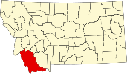 | |
| Town | ||
| CDPs | ||
| Other communities | ||
| Ghost towns | ||
Content Disclaimer
Informasi ini disarikan dari Wikipedia dan disajikan kembali untuk tujuan edukasi. Konten tersedia di bawah lisensi CC BY-SA 3.0. Kami tidak bertanggung jawab atas ketidakakuratan data yang bersumber dari kontribusi publik tersebut.
- The information displayed on this website is sourced in part or in whole from Wikipedia and has been adapted for the purpose of restating it. We strive to provide accurate and relevant information, however:
- There is no guarantee of absolute accuracy. Wikipedia is an open, collaborative project that can be edited by anyone, so information is subject to change.
- It is not intended to constitute professional advice. The content displayed is for informational and educational purposes only. For important decisions (e.g., medical, legal, or financial), please consult a professional.
- Content copyright. Wikipedia is licensed under the Creative Commons Attribution-ShareAlike License (CC BY-SA). This means that content may be reused with appropriate attribution and shared under a similar license.
- Responsible use. Any risk arising from the use of information from this website is entirely the responsibility of the user.