Melrand
| Melrand | |
 | |
| Verwàltung | |
|---|---|
| Land | |
| Region | |
| Département | Morbihan (56) |
| Arrondissement | Pontivy |
| Kànton | Pontivy |
| Kommünàlverbànd | Centre Morbihan Communauté |
| Àmtliga Nàma | Melrand |
| Maire | Charles Boulouard (2014-2020)[1] |
| Code Insee | 56128 |
| Poschtlaitzàhl | 56310 |
| Iiwohner | |
| Iiwohner | 1.598 |
| Flech | 40,39 km2 |
| Bevelkerungsdicht | 37,19 Iiw./km2 |
| Làg | |
| Koordinate | 47° 58′ 49″ N, 3° 06′ 42″ W / 47.980277777778°N,3.1116666666667°WKoordinate: 47° 58′ 49″ N, 3° 06′ 42″ W / 47.980277777778°N,3.1116666666667°W |
| Heche | 64 m |
 Melrand Melrand (Frànkrich) | |
| Website | |
| http://www.melrand.fr | |
Melrand (bretonisch Melrant) isch e franzesischi Gmai im Département Morbihan in dr Region Bretagne.
D Gmai ghert zum Kanton Pontivy un zum Arrondissement Pontivy.
Geografi
Melrand lyt 44 km vu Vannes un 32 km vu Lorient uf ere Hechi zwische 32 m un 161 m iber Normalnull. Nochbergmaine sin Persquen im Nordweschte, Guern im Norde, Le Sourn im Nordoschte, Inguiniel im Weschte, Bieuzy im Oschte, Bubry im Sidweschte, Quistinic im Side un Saint-Barthélemy im Sidoschte.
Gschicht
Melrand isch zum erschte Mol gnännt wore anne 1125 as Melran (1220: Melrant, 1221: Mealrant, 1301: Melerant, 1387: Melrand, 1467: Merlerant, 1636: Meslerent, 1636: Meslerent, 1779: Melreand).
Verwaltig
Dr Maire vu Melrand isch dr Charles Boulouard. Melrand ghert zum Kommunalverband Centre Morbihan Communauté.
Bevelkerigsentwicklig
| Johr | 1962 | 1968 | 1975 | 1982 | 1990 | 1999 | 2008 |
| Yywohner | 2.149 | 2.031 | 1.883 | 1.771 | 1.584 | 1.525 | 1.507 |
Dialekt
Dr traditionell Dialäkt vu Melrand ghert zum Bretonisch.
Anne 2006 sin zwoosproochigi Schuelklasse yygfiert wore. Im Johr 2007 sin 24% vu dr Schueler in zwoosprochigi Klasse gange, 2009 30 %, 2010 30 %[2].
Kultur un Böuwärch
- Tumulus Saint Fiacre
- Tumulus Motténic
- Tumulus Kob-Castel
- Chilche Saint-Pierre (15./16./17. Jh.)
- Kapäll Locmaria (16. Jh.)
- Kapäll Saint-Fiacre (15. Jh.)
- Kapäll Notre-Dame du Guelhouit (17. Jh.)
- Kapäll Saint-Laurent (15. Jh.)
- Kapäll Saint-Rivalain (18. Jh.)
- Kapäll Saint-Prisce (15. Jh.)
- Kapäll Sainte-Madeleine
- Village médiéval de l'an Mil, Lann-Gouh (Freiliechtmuseum mit eme rekonschtruierte Dorf us em 10/11. Jh.)
-
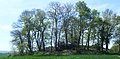
Tumulus Saint Fiacre -

Kapäll Saint-Fiacre -

Kapäll Saint-Prisce


Weblink
- http://www.melrand.fr
- Melrand uf geobreizh.com (Internet-Archive)
Fueßnote
- ↑ Liste des maires au 25 avril 2014 (data.gouv.fr)
- ↑ Ofis ar Brezhoneg: Enseignement bilingue
Content Disclaimer
Informasi ini disarikan dari Wikipedia dan disajikan kembali untuk tujuan edukasi. Konten tersedia di bawah lisensi CC BY-SA 3.0. Kami tidak bertanggung jawab atas ketidakakuratan data yang bersumber dari kontribusi publik tersebut.
- The information displayed on this website is sourced in part or in whole from Wikipedia and has been adapted for the purpose of restating it. We strive to provide accurate and relevant information, however:
- There is no guarantee of absolute accuracy. Wikipedia is an open, collaborative project that can be edited by anyone, so information is subject to change.
- It is not intended to constitute professional advice. The content displayed is for informational and educational purposes only. For important decisions (e.g., medical, legal, or financial), please consult a professional.
- Content copyright. Wikipedia is licensed under the Creative Commons Attribution-ShareAlike License (CC BY-SA). This means that content may be reused with appropriate attribution and shared under a similar license.
- Responsible use. Any risk arising from the use of information from this website is entirely the responsibility of the user.