Tingri
| Tingri དིང་རི་རྫོང་ 定日县 Định Nhật huyện | |
|---|---|
| — Huyện — | |
 | |
.png) Vị trí Tingri (đỏ) tại Xigazê (vàng) và Tây Tạng | |
.svg) Tingri | |
| Quốc gia | Trung Quốc |
| Khu tự trị | Tây Tạng |
| Địa khu | Xigazê (Nhật Khách Tắc) |
| Diện tích | |
| • Tổng cộng | 13.859 km2 (5,351 mi2) |
| Dân số | |
| • Tổng cộng | 50,000 |
| • Mật độ | 3,61/km2 (9,3/mi2) |
| Múi giờ | UTC+8 |
'Tingri (chữ Tạng: དིང་རི་རྫོང་; Wylie: ding ri rdzon; ZWPY: Tingri Zong; tiếng Trung: 定日县; bính âm: Dìngrì Xiàn, Hán Việt: Định Nhật huyện), là một huyện của địa khu Xigazê (Nhật Khách Tắc), khu tự trị Tây Tạng, Trung Quốc. Huyện bao gồm phần thượng của thung lũng sông Arun River, cũng các thung lũng của các chi lưu của sông này cộng với các thung lũng Rongshar Tsangpo và Lapchi Gang Tsanpo. Tingri có ranh giới phía nam với rặng núi chính của dãy Himalaya bao gồm cả các đỉnh núi Everest (Chomolungma), Makalu và Cho Oyo.
- Hiệp Cách Nhĩ (协格尔镇)
- Cương Dát (岗嘎镇)
|
|
- Tingri
-
 Mount Everest
 -
 Himalaya
 -
 Lalung La to Shelkar
 -
 Shelkar
 -

-
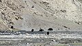 Yaks
Yaks -
 Gyatso La
 -
 Gyatso La 5248m


Tham khảo
Liên kết ngoài
- Trang thông tin Lưu trữ ngày 26 tháng 4 năm 2011 tại Wayback Machine (bằng tiếng Trung Quốc)

Bài viết liên quan đến Tây Tạng này vẫn còn sơ khai. Bạn có thể giúp Wikipedia mở rộng nội dung để bài được hoàn chỉnh hơn. |
Content Disclaimer
Informasi ini disarikan dari Wikipedia dan disajikan kembali untuk tujuan edukasi. Konten tersedia di bawah lisensi CC BY-SA 3.0. Kami tidak bertanggung jawab atas ketidakakuratan data yang bersumber dari kontribusi publik tersebut.
- The information displayed on this website is sourced in part or in whole from Wikipedia and has been adapted for the purpose of restating it. We strive to provide accurate and relevant information, however:
- There is no guarantee of absolute accuracy. Wikipedia is an open, collaborative project that can be edited by anyone, so information is subject to change.
- It is not intended to constitute professional advice. The content displayed is for informational and educational purposes only. For important decisions (e.g., medical, legal, or financial), please consult a professional.
- Content copyright. Wikipedia is licensed under the Creative Commons Attribution-ShareAlike License (CC BY-SA). This means that content may be reused with appropriate attribution and shared under a similar license.
- Responsible use. Any risk arising from the use of information from this website is entirely the responsibility of the user.