Share to: share facebook share twitter share wa share telegram print page


Uszód

Uszód
Map
Country Hungary
CountyBács-Kiskun
Area
 • Total
24.46 km2 (9.44 sq mi)
Population
 (2015)
 • Total
1,001[1]
 • Density40.9/km2 (106/sq mi)
Time zoneUTC+1 (CET)
 • Summer (DST)UTC+2 (CEST)
Postal code
6332
Area code78
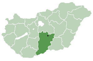
Location of Bács-Kiskun county in Hungary

Uszód (Croatian: Vusad) is a village in Bács-Kiskun county, in the Southern Great Plain region of southern Hungary.

History

The village was first mentioned in historical records in 1318.

Geography

It covers an area of 24.46 km2 (9 sq mi) and has a population of 1001 people (2015).[1]

Economy

The economy is primarily based on agriculture. The village has a village hall.

References

  1. ^ a b Gazetteer of Hungary, 1 January 2015. Hungarian Central Statistical Office. 3 September 2015


46°34′N 18°55′E / 46.567°N 18.917°E / 46.567; 18.917


Kembali kehalaman sebelumnya