Share to: share facebook share twitter share wa share telegram print page


Rumbek Airport

Rumbek Airport
The runway in 2004
Summary
Airport typePublic, Civilian
OwnerCivil Aviation Authority of South Sudan
ServesRumbek, South Sudan
LocationRumbek,  South Sudan
Elevation AMSL1,380 ft / 420 m
Coordinates6°50′N 29°40′E / 6.83°N 29.67°E / 6.83; 29.67 (Nimule Airport)
Map
Rumbek is located in South Sudan
Rumbek
Rumbek
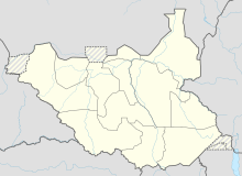
Location of Rumbek Airport in South Sudan
Map
Runways
Direction Length Surface
ft m
01/19 4,363.5 1,330 Unpaved

Rumbek Airport (IATA: RBX, ICAO: HSMK) is an airport in South Sudan, near Rumbek, the capital of Lakes State. The airport is served by several national airlines and by air charter service providers.

Location

Rumbek Airport is located in Rumbek Central County, Lakes State, in the Bahr el Ghazal Region of South Sudan, near the town of Rumbek. Its location lies approximately 302 kilometres (188 mi), by air, northwest of Juba International Airport, the largest airport in the country.[1] Rumbek Airport is located at an altitude of 420 metres (1,380 ft) above sea level.[2] The geographical coordinates of this airport are: 6° 49' 48.00"N, 29° 40' 12.00"E (Latitude: 6.83000; Longitude: 29.6700).

Airlines and destinations

Service was provided to Juba, South Sudan by Southern Star Airlines until the airline ceased flying in 2011.[citation needed]

AirlinesDestinations
Golden Wings Aviation Juba

Accidents and incidents

References

  1. ^ "Distance between Rumbek (Al Buhayrat) and Juba (Airport), Sudan". distancecalculator.globefeed.com. Retrieved 24 August 2018.
  2. ^ allmetsat. "Climate: Rumbek, Sudan". en.allmetsat.com. Retrieved 24 August 2018.
  3. ^ "3C-KKB Accident description". Aviation Safety Network. Retrieved 22 June 2010.
  4. ^ Ranter, Harro. "ASN Aircraft accident Beechcraft 1900C 5Y-FLX Rumbek". aviation-safety.net. Retrieved 24 August 2018.

6°49′48″N 29°40′12″E / 6.83000°N 29.67000°E / 6.83000; 29.67000

Kembali kehalaman sebelumnya