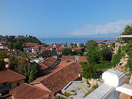
District and municipality in Antalya, Turkey
Muratpaşa
Kaleiçi (Old Town) in Muratpaşa, Antalya
Map showing Muratpaşa District in Antalya Province
Coordinates: 36°52′57″N 30°46′09″E / 36.88250°N 30.76917°E / 36.88250; 30.76917 Country Turkey Province Antalya • Mayor Ümit Uysal (CHP ) • Kaymakam Orhan Burhan 96 km2 (37 sq mi) Elevation
39 m (128 ft) Population 526,293 • Density 5,500/km2 (14,000/sq mi) Time zone UTC+3 (TRT )Postal code 07010, 07030–07050, 07100, 07160, 07200, 07230, 07300–07310
Area code (+90) 242 Website www
Muratpaşa is a municipality and district of Antalya Province , Turkey .[ 2] 2 ,[ 3] [ 1] Antalya , and has a coastline of 20 km (12 mi). The Mediterranean Sea lies to the south of the district. Ümit Uysal is the mayor of Muratpaşa.[ 4]
History
Düden Waterfall in Muratpaşa, Antalya Modern day district of Muratpaşa is home to Kaleiçi , the historic center founded by Attalus II, King of Pergamon around 150 BC. Since then, the district has been under Lydian , Roman , Persian , Byzantine , Seljuk , Cypriot , Teke , Ottoman , and —after the Italian occupation — Turkish rule.[ 5]
Composition
There are 55 neighbourhoods in Muratpaşa District:[ 6]
Altındağ
Bahçelievler
Balbey
Barbaros
Bayındır
Çağlayan
Çaybaşı
Cumhuriyet
Demircikara
Deniz
Doğuyaka
Dutlubahçe
Elmalı
Ermenek
Etiler
Fener
Gebizli
Gençlik
Güvenlik
Güzelbağ
Güzeloba
Güzeloluk
Haşimişcan
Kılıçarslan
Kırcami
Kışla
Kızılarık
Kızılsaray
Kızıltoprak
Konuksever
Mehmetçik
Meltem
Memurevleri
Meydankavağı
Muratpaşa
Sedir
Selçuk
Sinan
Şirinyalı
Soğuksu
Tahılpazarı
Tarım
Topçular
Tuzcular
Üçgen
Varlık
Yenigöl
Yenigün
Yeşilbahçe
Yeşildere
Yeşilova
Yıldız
Yüksekalan
Zerdalilik
Zümrütova
Landmarks
The Muratpaşa District in Antalya has many interesting and must-see places to visit
See also
References
External links
Districts Districts of Antalya


