|
Al Jumail
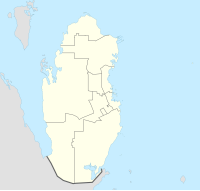
Al Jumail (Arabic: اَلْجُمَيْل) is an abandoned village in north-east Qatar located in the municipality of Al Shamal.[3][4] It was an important town in the northern peninsula prior to the 21st century. Nearby settlements include Ruwayda to the south-west and Yusufiyah and Abu Dhalouf to the north. EtymologyThe town's name comes from the Arabic word "jameel", which means "beautiful"; a reference to the trees that grow in the area year-round.[4] Various alternative transliterations of the name are used, such as Al Jemail, Al Jamil,[1] Lumail,[5] and Yamail.[6] HistoryIn the 1820s, George Barnes Brucks was tasked with preparing the first British survey of the Persian Gulf.[7] He documented Al Jumail in this survey, referring to it as "Yamale" and concisely stating that "Yamale, in lat. 26° 5' 40" N., long. 51° 14' E., is a small village."[8] In J.G. Lorimer's Gazetteer of the Persian Gulf written in the early 1900s, he makes mention of Jumail, noting its location as "midway between Abu Dhalouf and Khor Hassan", and states that it is also called Yamail or Lumail. He goes on to state that there are remains of houses and a fort.[9] GeographyAl Jumail is situated along Qatar's northern region. The coastline near Al Jumail includes various water inlets, both circular and elongated in shape. The area between Al Jumail and Ar Ru'ays is characterized by a narrowing of the coastal strip. This contrasts with the wider coastal areas found to the east. As part of the northern coastal plain region of Qatar, the surrounding area is notable for its flat terrain and lacks complex topographical features.[10] Gallery
References
|
||||||||||||||||||||||


