1988 United States presidential election in Colorado
1988 United States presidential election in Colorado
County Results
Bush
50–60%
60–70%
70–80%
Dukakis
50–60%
60–70%
70–80%
The 1988 United States presidential election in Colorado took place on November 8, 1988, as part of the 1988 United States presidential election , which was held throughout all 50 states and D.C. Voters chose eight representatives, or electors to the Electoral College , who voted for president and vice president .
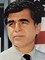
Colorado voted for the Republican nominee, Vice President George H. W. Bush , over the Democratic nominee, Massachusetts Governor Michael Dukakis , by a margin of 7.78%. Bush took 53.06% of the vote to Dukakis' 45.28%. While the Republicans held onto Colorado's eight electoral votes, Bush's 53–45 win over Dukakis represented a vastly diminished margin compared to 1984 , when Ronald Reagan had won the state in a 63–35 landslide over Walter Mondale . Unlike in the several preceding elections, Colorado voted roughly in line with the nation overall, which Bush won by 7.72%. Dukakis made substantial inroads by improving on Mondale's vote share in the city of Denver by over 10% (getting the highest vote share of any nominee in the city since Lyndon Johnson in 1964 ), becoming the first Democrat since 1964 (and only the second since 1936 ) to carry Boulder County , and comfortably reclaiming Pitkin County , which had supported McGovern in 1972 but had gone on to vote Republican in the next three elections.
As of the 2020 presidential election , this is the last election in which Summit County voted for a Republican presidential candidate.[ 1] Boulder or Saguache Counties since William Howard Taft in 1908 .
Results
Results by county
County
George H.W. Bush[ 3]
Michael Dukakis[ 3]
Various candidates[ 3]
Margin
Total votes cast
#
%
#
%
#
%
#
%
Adams
43,163
45.87%
49,464
52.57%
1,467
1.56%
-6,301
-6.70%
94,094
Alamosa
2,567
53.70%
2,146
44.90%
67
1.40%
421
8.80%
4,780
Arapahoe
95,926
60.24%
61,113
38.38%
2,206
1.38%
34,813
21.86%
159,245
Archuleta
1,440
63.66%
795
35.15%
27
1.19%
645
28.51%
2,262
Baca
1,670
65.34%
851
33.29%
35
1.37%
819
32.05%
2,556
Bent
1,032
47.62%
1,088
50.21%
47
2.17%
-56
-2.59%
2,167
Boulder
48,174
44.93%
57,265
53.41%
1,784
1.66%
-9,091
-8.48%
107,223
Chaffee
3,080
53.90%
2,548
44.59%
86
1.51%
532
9.31%
5,714
Cheyenne
760
64.08%
399
33.64%
27
2.28%
361
30.44%
1,186
Clear Creek
1,820
50.11%
1,698
46.75%
114
3.14%
122
3.36%
3,632
Conejos
1,445
41.92%
1,976
57.33%
26
0.75%
-531
-15.41%
3,447
Costilla
454
28.72%
1,120
70.84%
7
0.44%
-666
-42.12%
1,581
Crowley
862
57.47%
630
42.00%
8
0.53%
232
15.47%
1,500
Custer
753
69.46%
310
28.60%
21
1.94%
443
40.86%
1,084
Delta
5,449
59.59%
3,521
38.51%
174
1.90%
1,928
21.08%
9,144
Denver
77,753
37.13%
127,173
60.72%
4,504
2.15%
-49,420
-23.59%
209,430
Dolores
488
66.67%
230
31.42%
14
1.91%
258
35.25%
732
Douglas
17,035
69.96%
6,931
28.46%
384
1.58%
10,104
41.50%
24,350
Eagle
4,366
55.91%
3,314
42.44%
129
1.65%
1,052
13.47%
7,809
El Paso
96,965
70.03%
39,995
28.88%
1,506
1.09%
56,970
41.15%
138,466
Elbert
2,805
63.06%
1,566
35.21%
77
1.73%
1,239
27.85%
4,448
Fremont
7,623
58.24%
5,278
40.33%
187
1.43%
2,345
17.91%
13,088
Garfield
6,358
57.21%
4,620
41.57%
136
1.22%
1,738
15.64%
11,114
Gilpin
728
45.79%
804
50.57%
58
3.64%
-76
-4.78%
1,590
Grand
2,306
60.08%
1,451
37.81%
81
2.11%
855
22.27%
3,838
Gunnison
2,520
55.72%
1,897
41.94%
106
2.34%
623
13.78%
4,523
Hinsdale
295
72.48%
111
27.27%
1
0.25%
184
45.21%
407
Huerfano
1,079
36.32%
1,876
63.14%
16
0.54%
-797
-26.82%
2,971
Jackson
584
65.54%
294
33.00%
13
1.46%
290
32.54%
891
Jefferson
110,820
56.39%
81,824
41.64%
3,867
1.97%
28,996
14.75%
196,511
Kiowa
645
61.25%
398
37.80%
10
0.95%
247
23.45%
1,053
Kit Carson
2,262
64.41%
1,196
34.05%
54
1.54%
1,066
30.36%
3,512
La Plata
7,714
57.73%
5,443
40.73%
205
1.54%
2,271
17.00%
13,362
Lake
969
38.10%
1,516
59.61%
58
2.29%
-547
-21.51%
2,543
Larimer
45,967
55.34%
35,703
42.98%
1,396
1.68%
10,264
12.36%
83,066
Las Animas
2,162
34.15%
4,075
64.37%
94
1.48%
-1,913
-30.22%
6,331
Lincoln
1,356
60.29%
874
38.86%
19
0.85%
482
21.43%
2,249
Logan
4,485
56.24%
3,382
42.41%
108
1.35%
1,103
13.83%
7,975
Mesa
22,150
59.62%
14,372
38.68%
633
1.70%
7,778
20.94%
37,155
Mineral
217
55.08%
174
44.16%
3
0.76%
43
10.92%
394
Moffat
2,757
61.01%
1,634
36.16%
128
2.83%
1,123
24.85%
4,519
Montezuma
4,208
64.23%
2,233
34.09%
110
1.68%
1,975
30.14%
6,551
Montrose
6,012
60.16%
3,748
37.51%
233
2.33%
2,264
22.65%
9,993
Morgan
4,795
55.24%
3,728
42.95%
157
1.81%
1,067
12.29%
8,680
Otero
4,265
51.39%
3,910
47.11%
124
1.50%
355
4.28%
8,299
Ouray
814
63.89%
439
34.46%
21
1.65%
375
29.43%
1,274
Park
1,909
56.87%
1,343
40.01%
105
3.12%
566
16.86%
3,357
Phillips
1,317
57.81%
923
40.52%
38
1.67%
394
17.29%
2,278
Pitkin
2,801
44.28%
3,420
54.06%
105
1.66%
-619
-9.78%
6,326
Prowers
2,978
56.34%
2,207
41.75%
101
1.91%
771
14.59%
5,286
Pueblo
20,119
37.73%
32,788
61.50%
411
0.77%
-12,669
-23.77%
53,318
Rio Blanco
1,821
68.41%
803
30.17%
38
1.42%
1,018
38.24%
2,662
Rio Grande
2,626
62.01%
1,545
36.48%
64
1.51%
1,081
25.53%
4,235
Routt
3,264
51.65%
2,922
46.24%
133
2.11%
342
5.41%
6,319
Saguache
945
46.94%
1,033
51.32%
35
1.74%
-88
-4.38%
2,013
San Juan
210
50.36%
192
46.04%
15
3.60%
18
4.32%
417
San Miguel
798
43.39%
961
52.26%
80
4.35%
-163
-8.87%
1,839
Sedgwick
921
59.61%
611
39.55%
13
0.84%
310
20.06%
1,545
Summit
2,893
51.44%
2,595
46.14%
136
2.42%
298
5.30%
5,624
Teller
3,760
68.36%
1,656
30.11%
84
1.53%
2,104
38.25%
5,500
Washington
1,707
62.87%
958
35.29%
50
1.84%
749
27.58%
2,715
Weld
26,497
55.42%
20,548
42.98%
762
1.60%
5,949
12.44%
47,807
Yuma
2,513
56.93%
1,835
41.57%
66
1.50%
678
15.36%
4,414
Total
728,177
53.06%
621,453
45.28%
22,764
1.66%
106,724
7.78%
1,372,394
Counties that flipped from Republican to Democratic
References


